Waiheke on a Budget »
Last Update: September 2023
Sometimes it’s the simple, rather than the expensive things in life, that create....
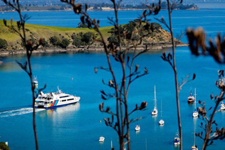
Waiheke is the second largest island ( 92 square km ) in the Hauraki Gulf, after Great Barrier Island. Regular passenger and vehicle ferry services ( a 35-minute ferry ride from Auckland ) has helped make the island the most populated and accessible island in the Gulf. The island is growing in popularity and now has a population over 9,000 many of whom commute to Auckland for work. Numbers swell significantly during the summer months and holiday periods.
The islands were probably among the first places settled by east Polynesian voyagers to Aotearoa ( New Zealand ) some 800 years ago. The two great, ocean-going waka ( canoes ), Tainui and Te Arawa, arrived in the Hauraki Gulf almost simultaneously some 600 to 700 years ago.

Photo: The early Polynesian Waka – view photo credit / source
The Tainui made landfall a short distance away at Gannet Rock, off the north eastern tip of the island, to perform a ritual whereby its crew laid claim to the Gulf.
At about the same time, the Te Arawa made landfall on the island itself, at the Putiki inlet, directly to the north of Whakanewha, to make much needed repairs after their arduous voyage. The surrounding area is named Te Rangihoua meaning ‘the day of renewal’ which relates to the re-lashing of their waka.
The maunga ( mountain ) where they landed was named Te Pūtiki o Kahumatamomoe ‘the top knot of Kahumatamomoe’. Kahumatamomoe was the son of Te Arawa chief and ancestor, Tamatekapua. Once repairs were complete the Te Arawa waka continued around Cape Colville and onto the Bay of Plenty, before making final landfall at Maketu.
Kahumatamomoe and the Princess Kura, also of the Te Arawa crew, later returned taking possession of the island and assigning their own names to geographical features establishing ownership and mana. Kahumatamomoe named Waiheke, Motu nui no Kahu, and established the first pā ( fortified village ) on the maunga, Te Pūtiki o Kahumatamomoe, occupying it as a hill fort.
This pā was to feature repeatedly in the significant events of the ensuing period of Māori history due to its close location to populous parts of the island and also the most likely invasion route being the Tāmaki Strait.

Photo: View overlooking Rangihoua towards the Putiki inlet on top of first pā, Te Pūtiki o Kahumatamomoe.
The island sheltered waka traffic passing through the Tamaki Straight from bad weather coming in from the north, and perhaps because of this the island became known as Te Motu-arai-roa, ‘the long sheltering island’.
All waka travelling between the Bay of Islands and the Bay of Plenty ( and beyond to the East Coast ) passed close by, often meeting, fighting, and occasionally displacing one another. These conditions led to turbulent times for the islanders, whose homes could never be entirely secure. To defend and protect themselves they strengthened the headlands and summits as pā to serve as safe haven for times of danger. From the first traces of settlement in the 1400s, various iwi ( tribes ) invaded and occupied the island.
Whilst several iwi’s have connections to the island it was the Ngati Paoa that claimed the island as tangata whenua ( people of the soil ) from about 1700.
The Ngati Paoa, a branch of Tainui, split from the parent tribe and migrated north out of Waikato in the 1600s, colonising the western shores of the Hauraki Gulf. They lived in relative peace with pre-existing Hauraki iwi, forming the Marutuahu alliance. An Alliance that involved Ngati Maru, Ngati Whanaunga and Ngati Tamatera.
As the northern flank of Ngati Paoa met the south-moving Ngati Whatua, a series of battles on the Tamaki isthmus ended in a stalemate, with Ngati Paoa holding the eastern side of Tamaki and occupying gulf islands, including Waiheke.
In the late 1700s, Ngapuhi, pushing south from Northland, challenged the Waitemata holdings of both tribes but they were blocked in a series of epic battles, central to which was Marutuahu’s naval dominance. The Putiki-o-Kahu pā strategically sited on Waiheke, and a fleet of famous war canoes gave the locals the upper hand in these engagements. When Captain James Cook anchored just off Man O’ War Bay ( Eastern side of Waiheke ) in 1769, the Ngati Paoa were still in residence.
Captain James Cook onboard HMS Bark Endeavour travelled to these waters on orders from the British Admiralty. The orders were to search for a great continent within the Southern hemisphere that was believed to balance the world.

Photo: The Endeavour replica drops anchor in Mercury Bay. Cook spent time in the area observing the transit of Mercury in 1769 – Photo Credit: Christel Yardley | STUFF
As he rounded the top of the Coromandel peninsula, Cook mistook the eastern ends of Ponui, Waiheke and Motutapu for extensions of the mainland, writing “it appear’d very probable that these form’d some good harbours”. He dropped anchor off Pakatoa Island ( opposite the Eastern bays of Waiheke ) on his exit from the Hauraki Gulf in late November 1769. Upon sighting the ancient stands of magnificent Kauri trees ashore, Cook noted in his journals that…
They would make ideal masts for the Man O’ War battleships of the Royal Navy.
The man-of-war was a Royal Navy expression for a powerful warship or frigate from the 16th to the 19th century. Whilst there are few Kauri trees remaining the name for the bay has remained.
It was Cook’s favourable report on visiting the Firth of Thames ( Coromandel ) in 1769 that encouraged whalers and sealers to frequent the area, and Waiheke became a pit stop for ship repairs. Iron and other goods were traded with Ngati Paoa for potatoes, a crop introduced by the earliest European ships which grew freely in the fertile soils. But the tribe’s economic boom ground to a halt when a series of ship-borne epidemics decimated the population. The first, in 1795, was described as so terrible that “the living could scarcely bury the dead”. Māori had little or no natural immunity to these diseases so suffered heavy mortality, particularly from measles and influenza. Ship visits to the region were terminated.
**
Certainly by the 1800’s – the Island had also become known as Waiheke. This name was first recorded in 1820, when it appeared on one of the earliest maps. According to the historical society ( http://www.waihekemuseum.org.nz/ ) James Downie, the master of the store ship HMS Coromandel made a chart of the Tamaki Strait and the Coromandel coast. He labeled the island Motu Wy Hake, spelling the name as he heard it.
Wai meaning water; Heke meaning to ebb, drip, trickle or descend. Waiheke thus meaning “The descending waters” or “Trickling waters”.
In light of the fact that the island does not have waterfalls and only a few springs, this name seems somewhat strange. Though a common explanation is that early surveyors were given the name of one of these springs when they asked their Maori guides for the name of the island.
**
By the time of the arrival of the English missionary Samuel Marsden in 1814, Ngati Paoa had bounced back, but it was short-lived. The legendary Ngapuhi chief Hongi Hika was still brooding on the failure of his people to capture the lands to the south and he harboured an obligation and strong personal wish to avenge the Ngāpuhi defeat.
In 1820, Hongi visited England and assisted Professor Samuel Lee ( at Cambridge ) in putting together the Māori dictionary. However, his main aim of course, which was ultimately achieved, was to acquire muskets. His acquisition of weaponry altered the balance of power.
With his newly acquired armoury of muskets, he had the Hauraki tribes, and especially Ngati Paoa, firmly in his sights. In 1821 some 2,000 well armed Ngapuhi warriors set off from the Bay of Islands and descended on the Ngati Paoa settlements of Tamaki. The defenders were overwhelmed and mercilessly slaughtered.
Hongi Hika then turned his attention to the previously unassailable bastion of Waiheke ( An island that for 60 years had successfully defeated any claim ), and another one-sided battle took place. Onetangi means “Weeping Sands” in Maori, a name referring to a battle that took place during these Musket Wars.
With no answer to guns, the Ngati Paoa took flight down the Firth of Thames but were overtaken, and many more were slaughtered on the beach near Kaiaua. A few straggling survivors sought refuge in Waikato, and Waiheke Island, though much of the Hauraki, for a while, was left virtually uninhabited.
Europeans moved upon these emptied lands, and on Waiheke it was with an appetite for the stands of highly prized timber trees. Kauri spars were loaded at Man O’ War Bay and shipped to Sydney or beyond.
The Ngapuhi iwi had sought revenge and glory rather than land. In 1828 Hongi Hika died, and any remaining Ngāpuhi threat diminished. Ngati Paoa occupied the main ‘trading and raiding route’ of the time, but as their lands were not occupied, the Ngati Paoa were eventually able to return. The Waitangi Tribunal, in its Waiheke Island Report, noted that…the return to Waiheke came later when the Ngapuhi chief, Patuone, married the Ngati Paoa chieftainess Riria in a peace arrangement, and settled on Waiheke at Putiki Pa.
In the 1830s aware of their vulnerability, Ngati Paoa sought to deal with the apparently benign Europeans. The missionaries promised them a peace treaty, the Treaty of Waitangi, though for many iwi this Treaty of peace was born in the wake of the musket. Fearful of another attack they willingly signed in 1840.

Photo: The signing of Treaty of Waitangi, signed at the Waitangi on 6th Feb 1840 – Photo Credit: https://www.waitangi.org.nz/
They quickly became disillusioned with this pact as Government land purchasing officers immediately began to acquire nearly all lands around Auckland. Most of Waiheke had been purchased for negligible sums by 1860. The Tainui iwi ( tribe ), attempting to preserve their remaining assets, endorsed the anti-land-sales policy, which Governor Sir George Grey interpreted as a challenge to the Crown. He sent troops to Waikato in 1863, and Ngati Paoa came to their aid in light of the ensuing conflict. Their punishment was the confiscation of the bulk of their lands by the Crown, and only some sleight of hand allowed them to retain a place on Waiheke.
Some Ngati Paoa, that were dispossessed on the mainland, returned to Waiheke, but in 1865 the newly established Maori Land Court refused to deal with tribes as distinct entities, therefore splitting up tribal lands and awarding blocks to individuals, which were then acquired piecemeal until the tribal base had vanished.
Only a few hectares, including burial grounds, remain as Maori lands on Waiheke today.
Seals, whales and wood were among New Zealand’s first trade goods. The Royal Navy found that New Zealand was a good source of spars – long poles used as masts and booms – with kauri being particularly favoured.
The availability of kauri spars, fresh water and firewood between Cowes and Man O’War Bays made the Waiheke Channel a popular route for outward-bound shipping from Auckland. By the 1850s, there were only sufficient spars to meet the needs of individual ships and ship loads of spars were already a thing of the past. Kauri was worked in saw pits on Waiheke until the late 19th century, but there was insufficient timber to warrant a local mill.
Shipbuilding, a spin-off from kauri extraction, was important on Waiheke ( about 12 vessels from 15 to 60 tons were built ) and Great Barrier ( including the 400 ton Stirlingshire built in 1847, the largest ship in New Zealand at the time ) until the 1860s.
Waiheke was also Auckland’s principal source of firewood, with smaller quantities coming from more distant Great Barrier. Much of the islands’ forests were cut to supply the first stage in Auckland’s urban and industrial development, either as fuel or building timber.
Mining seemed to offer good economic prospects in the gulf. Manganese was mined on Waiheke briefly in the 1840s and then more extensively from 1872 until 1900.
In the 1880s another extractive industry began on the islands: the removal of shingle and sand for use in concrete construction in Auckland, notably the Grafton Bridge. Scows ( a type of flat-bottomed barge ) were run onto beaches two hours after high tide, loaded and re-floated on the next high tide.
Scows were particularly active at Owhanake and Hooks bay. Work above the high water line led to coastal erosion that is still visible today. Huge quantities of shingle and sand were also removed from Ponui and Pakihi. In about 1920 the best beaches had already mined out and the practice was stopped on Waiheke.

Photo: Shingle at Hooks Bay
In the 1840s and 1850s the local Maori supplied the young settlement of Auckland with wheat and vegetables. In the heyday of this trade ( the early 1850s ), ship’s surgeon John Jolliffe recorded the presence of extensive Maori wheat cultivations in all of Waiheke’s eastern bays. By 1860 the trade was in steep decline, but Maori from Te Huruhi in western Waiheke continued to grow food for Auckland until the early 20th century.
Forest clearance was the first step towards pastoral farming. The industry began with cattle grazing on bush and fern land. By the 1880s only small stands of mature forest remained on Waiheke and the island’s main pastoral properties were taking shape. Between 1900 and 1920 the process of converting forest into pasture for stock was complete.
From the late 1870s the recreational values of the gulf were increasingly appreciated. In the 1880s steamer excursions began to Waiheke, Motutapu and other islands. Happy crowds of day trippers enjoyed picnics, bathing, beach games and regattas.

Photo: Cowes Bay. Waiheke Island, circa 1905 Photo Credit: George Bourne and Auckland Museum
In 1893 a Weekly News journalist declared:
“Aucklanders are beginning to realise what a beautiful resort Waiheke Island is, and this summer is doing much to establish its reputation as the watering place of Auckland par excellence“.
Boarding houses flourished at Cowes, Orapiu and Awaawaroa, with those at Cowes matching the best in the country. The more affluent Aucklanders, who owned yachts, found their own way out to the islands, especially to the western bays of Waiheke.
Opportunities for the recreational enjoyment of the gulf were greatly enhanced by the subdivisions on Waiheke: Orapiu and Ostend in 1916, Onetangi and Surfdale in 1921, Palm Beach in 1922, Rocky Bay in 1923 and Oneroa in 1924. No longer were visitors restricted to day trips; now at modest cost they could own baches for holidays or retirement.
In the absence of local government, the subdivisions were private ventures carried out independently following Public Works regulations. These made landowners responsible for their own roads and wharves. Waiheke’s idiosyncratic road system ( notably, the main road between Oneroa and Onetangi, with its many name changes and unexpected turns ) is an enduring legacy of this. Each subdivision generated its own vibrant, self-contained community, represented today by historic community halls, stores and post offices.
Stony Batter was to be part of Auckland’s defences during World War Two, but construction did not start until 1943, and it was not completed by war’s end in 1945. It was originally designed for a 9.2-inch gun with deep underground magazines to store ammunition. The tunnels have recently undergone restoration and are now open for tours.
